
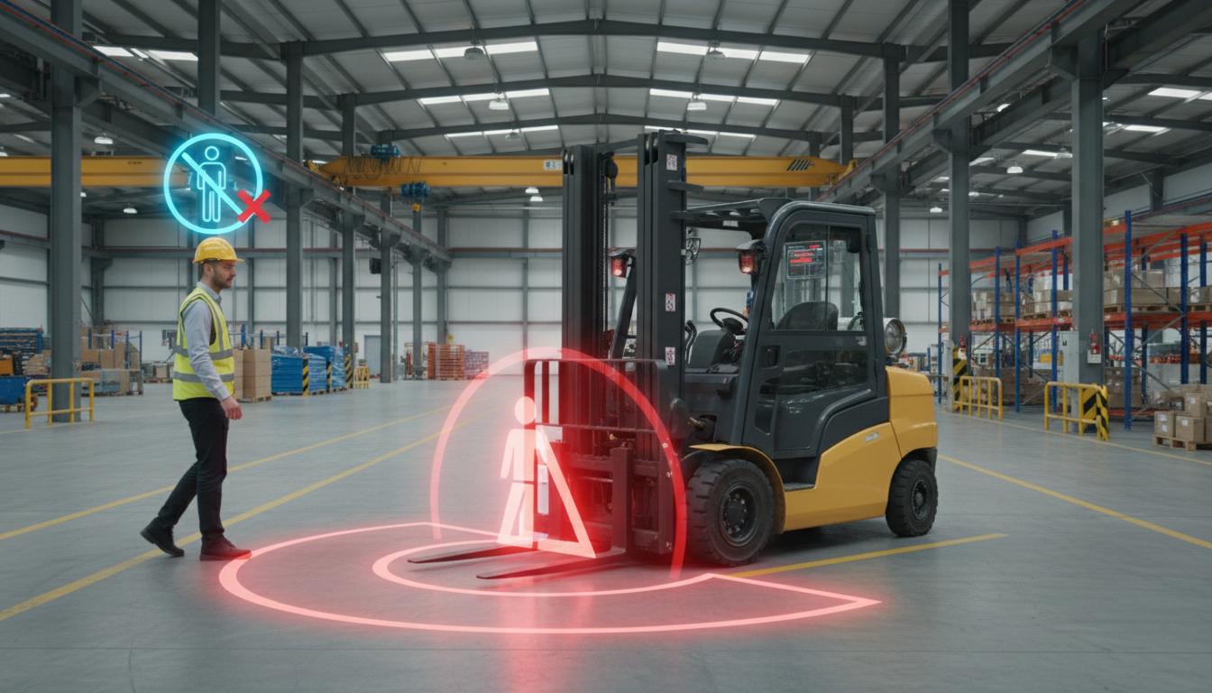
Principles, Scenarios and Suitability
Images of forklifts and pedestrians can support layout and proximity-event reviews, but image distances are not physical distances until calibrated. Use them to assist traffic management, not as a vehicle-stopping system or assurance of collision avoidance.
Forklifts have projecting parts and blind areas a single view may miss. Nearby image points may occupy different elevations or be far apart physically. A trajectory is a path tracked over time, not a prediction of where someone will walk. Use results to ask where shared use is frequent and whether separation measures suffice, not to judge fault or risky intent from image distance.
Ground calibration converts positions into physical units but needs checks for camera movement and slopes. Wider alert zones reduce misses but create more events from normal walking. Traffic supervisors should choose according to layout and context, reviewing source-image time and delay. Retrospective analysis can improve space management even when unsuitable for immediately stopping vehicles, a separately designed protective task.
Scroll the diagram horizontally to inspect all details.
Illustrative Design Scenario
Illustrative design scenario: summarise crossing-zone events so supervisors can improve walkways and transport schedules. Review video and context before confirming possible proximity events. Image distance alone does not establish fault by a driver or pedestrian.
Suppose repeated junction events appear during deliveries. Review whether crossing follows signals or a blind spot remains unresolved by the existing layout. Options include separating goods movement from pedestrian periods or changing walkways. Scheduling adds coordination; layout changes need review of escape routes and other work. Adding lines on a screen does not establish real risk reduction.
Use authorised video and simulated data to explain events, with supervisors and workers reviewing together without accusations. Test distances with reference objects and safe procedures. Never have people approach moving vehicles to create test events. Future alerts must still leave barriers, walkways and training as primary measures.
Inputs and Prerequisites
Provide walkway maps, blind spots, actual operating speeds, coordinate systems and camera coverage. Set privacy policies that avoid unnecessary identification or tracking of people across areas.
Record camera positions, height, slopes and unseen areas. Obtain speed information from permitted sources, not by driving beyond operating limits to create examples. Limit personal images to the area-management purpose.
Results should show zone, time, actually observed paths and occluded periods, with uncertain-distance status. Do not score fault or driving skill. Extrapolated information beyond blind spots must be distinct from observed positions.
Trial and Integration Workflow
- 1Assess risks and define areas with the site traffic team.
- 2Calibrate the ground plane and track trajectories with occlusion status.
- 3Have people review events and prioritise physical separation of vehicles and pedestrians.
Evaluation and Acceptance Criteria
Check missed events and false alarms by blind spot, measuring physical-distance errors against references where available. Test night-time and occlusion cases without creating real danger. Include the delay from image capture to alert delivery.
Count events by passage, not multiple frames of one incident. Evaluate location accuracy and identity switches separately from zone entry. Tracking the wrong object can create an incorrect alert despite good detection boxes.
Supervisors should also review periods without alerts to identify misses, checking camera coverage on the map. Report uncovered areas and review workload. Video scores are not field measurements of collision reduction and must not be reported as such.
Scroll the diagram horizontally to inspect all details.
Failure Cases and Limitations
Different elevations, occlusion and camera vibration distort distance. General vision is not certified collision avoidance and does not replace barriers, junction design, mirrors, speed limits or training. Human review is required for conclusions about events.
Seeing a pedestrian does not establish that the driver saw them. Safe distance depends on load, speed and location. This article provides no universal distance or permission to continue driving without alerts; use actual risk assessment.
Records must not build unnecessary personal profiles or support automatic punishment. Traffic guidance is a study framework, not certification of collision avoidance or a claim of already installed vehicle control.
Practical Checklist
- Are reference distances expressed in physical units, not pixels?
- Does testing avoid placing people near moving forklifts?
- Are events reviewed without any automatic disciplinary action?